
This geospatial hack weekend took place on Saturday 28th Nov 2020 and Sunday 29th Nov 2020. We had 19 people on day one and 18 on day two.
From the range of previously proposed projects, attendees elected to work on four, and teams were formed to do that. We created a parent GitHub repo for the event, and a repo for each project.
We used our main Zoom session to hold the space and alternated between main room where everyone should be together, and breakout rooms for group work in 90 minutes blocks of time. We then came back together to check in on how teams were getting on, and to share information and offers of help.
We used Slack and our Code the City workgroup as the back channel between rooms, and to coordinate the event outside of Zoom. This worked well in the run-up to the event, and also as the jumping off point for each day.
We added the use of Miro to the mix this time. Participants were encouraged to add a photo and something about what they had to offer, and also what they hoped to gain from the event, so that people knew more about each other. We also had a whiteboard for each team too. Some used this as a task board, others documented their work process, and others captured notes and brainstormed use cases and scenarios.
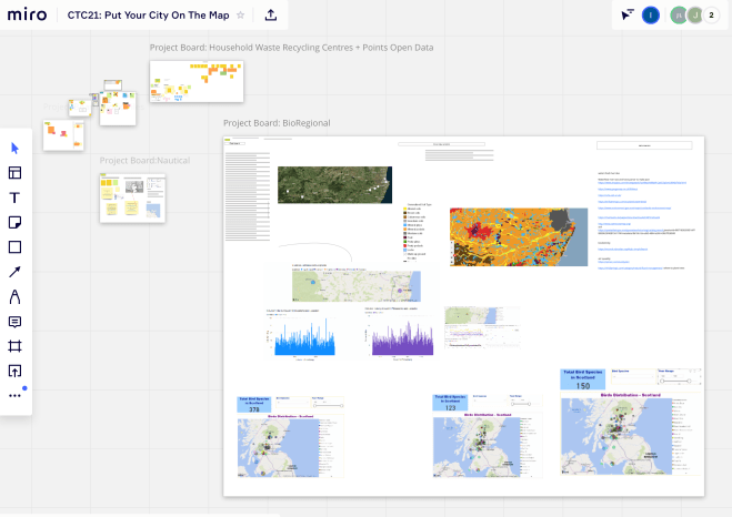
Team BioRegional Dashboard
This team worked on establishing what a bio-regional dashboard for the Dee valley would look like, what the content would be, data sources, and how to build it.
This post-event write-up explains the project, and contains a video of the final presentation.
Team Doric Tiles
This project concentrated on translating place names into Scots in the OSM – specifically Doric, for the north-east region, but expandable into other dialects of the Scots language for other regionalities.
There is also a view to having a Gaelic language overlay to show and contrast the placenames in Scotland’s three national languages.
There was also a proof of concept iOS app created using data from this and previous CTC projects. There is a write up about the app.
Team Nautical Wrecks
The team’s GitHub repository
This project aimed to find data about the shipwrecks of the North East, adding those to Wikidata.
Read more about it in this blog post which also highlights some challenges that the team faced in gaining openly licensed data, and matching that to the Wikidata data model.
Team Waste Wizards
Code for the project on GitHub
This was a project exploring the use of open data in the management of waste and recycling, and particularly at the use of Open StreetMap, Wikidata and how those data repositories support informed decision making around waste and recycling.
Post-event write-ups.
We will add links to blog posts as we get sent them.
The remainder of this page is as it was before we added the post-event write-up.
Ian
Maps, and the geographic data that underpins them, help people make sense of their world, from the hyperlocal to global.
In this, Code The City’s 21st, hack event we’ll be using maps, software, open data and programming tools to create, update, digitise and modernise maps of our locales. We’ll have sessions on how to use tools and platforms, and we’ll have projects that anyone can get involved in.
This event is for you
- if you love maps, or
- if you want to learn more about how to edit shared data sources,
- if have a project that could benefit from mapping, or geospatial analysis – such as mapping local flooding,
- if you want to query some open data, or make sure that your neighbourhood is up to date on OpenStreetMap ,
- if you want to digitise historic maps to show how your city has changed.
Whether you’ve attended hack events or not, there are lots of ways you can contribute (whatever your background and skill set), and you will find it really satisfying to work in small teams to gain new skills, try out new ideas and prototype solutions in a supportive environment.
And of course, it will be fully online – we will be using Zoom so that everyone can interact throughout the event – so you don’t even have to journey to Aberdeen to take part.
We’re working on finalising the exact format but the weekend will resemble this
Sat 28 November
- 09:30 Introductions
- 10:00 Identify potential projects, form teams
- 10.30 Break-out sessions to familiarise ourselves with some of the tools and platforms
- 11.30 Projects start
- 12.30 Lunch (Grab some food and socially chat while you eat, or break away from the screens for a while)
- 13:30 Projects continue
- 17:00 Wrap up for day one
Sun 29 November
- 09:30 Projects start
- 12.00 Lunch (Grab some food and socially chat while you eat, or break away from the screens for a while)
- 13:00 Projects continue
- 15:30 Show and tell
- 16:30 Event close
Throughout the weekend we will have regular check-ins where we speak about our projects and hear what others are doing.
You can book a ticket now at https://ti.to/code-the-city/ctc21-put-city-on-map
By signing up for this hack weekend, you agree to our Code Of Conduct.
Who should attend?
Anyone – despite our name, coding is a small bit of what we do.
Of course, coders, data wranglers, designers and other techies are important to a hack weekend.
We’d be delighted to see you if:
- You are interested in using mapping or geospatial analysis
- You are interested in data science or data visualisation, or using geospatial data in novel ways
- You are a GIS professional, or an OpenStreetMap contributor
- You have identified an opportunity to use mapping tools to solve a problem
- You have an interest in service design
- You work or study in the creative industries
- You are someone who wants to do more with data but isn’t sure where to start
- You are a student (of any discipline)
- You are someone who wants to improve the local area, or use digital and skills to improve local services
- You are from the third sector or local government
- You are curious about learning new techniques and skills to use in your day job, and finally
- And, of course, if you are a developer, designer, UX expert, data wrangler, coders, or service designer
So it’s a Geospatial hack?
Yes. Put simply, geospatial means “of or relating to the relative position of things on the earth’s surface.” Whether it is the location of a building or other physical structure, the boundary of a council area, or the number of people in each location who have influenza this month, geospatial data helps us get a handle on abstract concepts by linking them to a point, line or shape on a map.
We’ll be looking at opportunities to improve existing data, such as OpenStreetMap, and looking at how we analyse and present data in a geographic way – whether it is where to find a post-office, a defibrillator, compare Covid19 levels, map flood risk areas or the location of recycling centres. We’ll be identifying opportunities and barriers to improving the collation, presentation and understanding of data about Aberdeen City and Shire. Some of those will turn into coding projects – and some will all be about research, service design and paper prototyping.
Suggested projects
We have a growing list of possible projects.
Tutorials, Tips and Training
We also have a growing list of training materials.
What happens over the weekend?
At a typical weekend we follow this process:
- Identification of opportunities and barriers.
- Ideation to address the opportunities and barriers.
- Creation of project teams to work on the ideas.
- Agile prototyping of solutions, so that by close of play Sunday we will have demonstrable solutions which could be developed into real world products or services.
In this event we will also aim to provide some guidance or instruction on the use of mapping tools.
